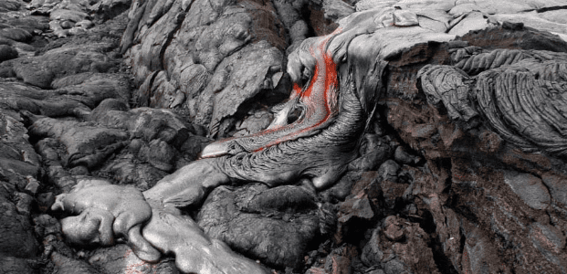
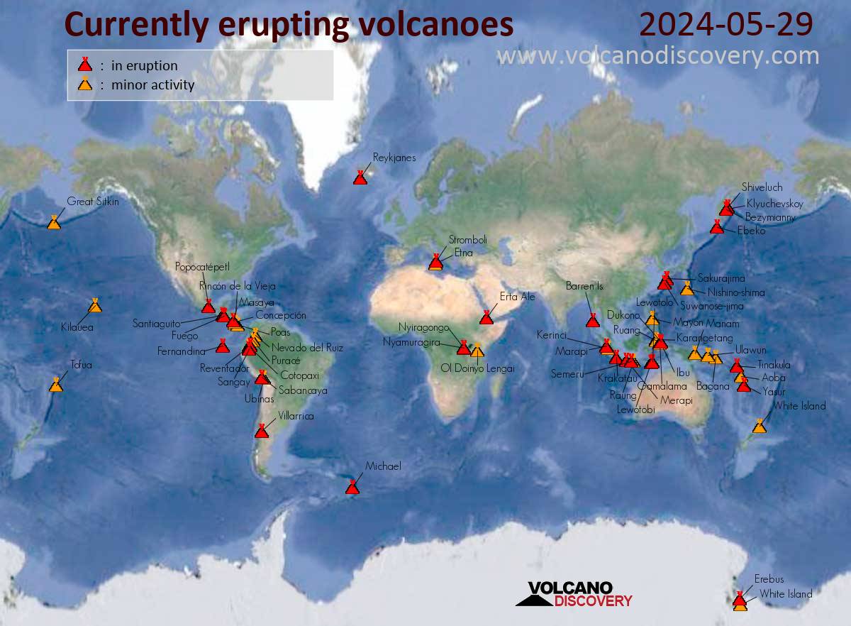
![Map of today's active volcanoes]()
Map of today's active volcanoes
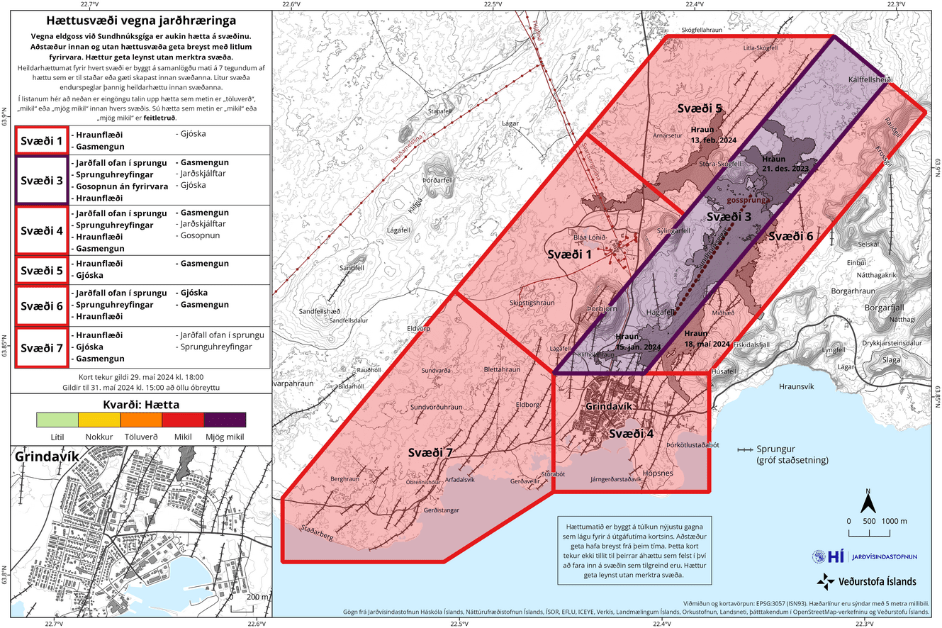
: The risk assessment has been updated due to the ongoing eruption.
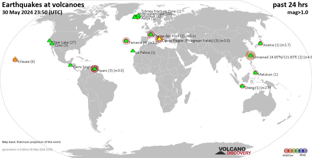
![The hazard map is valid from 29 May until further notice (image: IMO)]()
The hazard map is valid from 29 May until further notice (image: IMO)
The risk assessment has been updated due to the ongoing eruption.
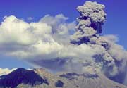
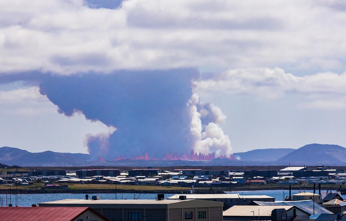
![Gas-steam-abundant emissions from the eruption site with lava fountains in the foreground (image: @Vikurfrettir/X)]()
Gas-steam-abundant emissions from the eruption site with lava fountains in the foreground (image: @Vikurfrettir/X)
The activity at the eruption site continues.
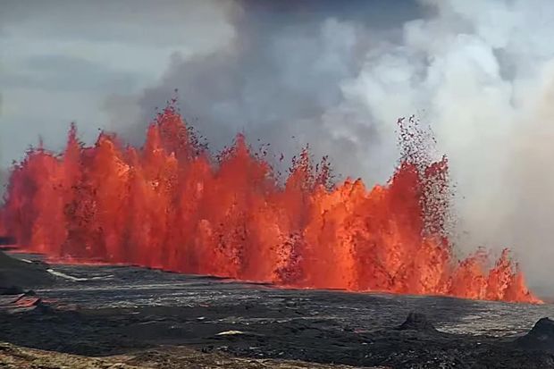
![Vigorous fountaining at the eruption site (image: @Icevolcanx/X)]()
Vigorous fountaining at the eruption site (image: @Icevolcanx/X)
A new effusive eruption began on the Reykjanes Peninsula at about 14:00 local time today. This marks the 5th eruption in the same area since December last year.
Wed, 29 May 2024, 14:00
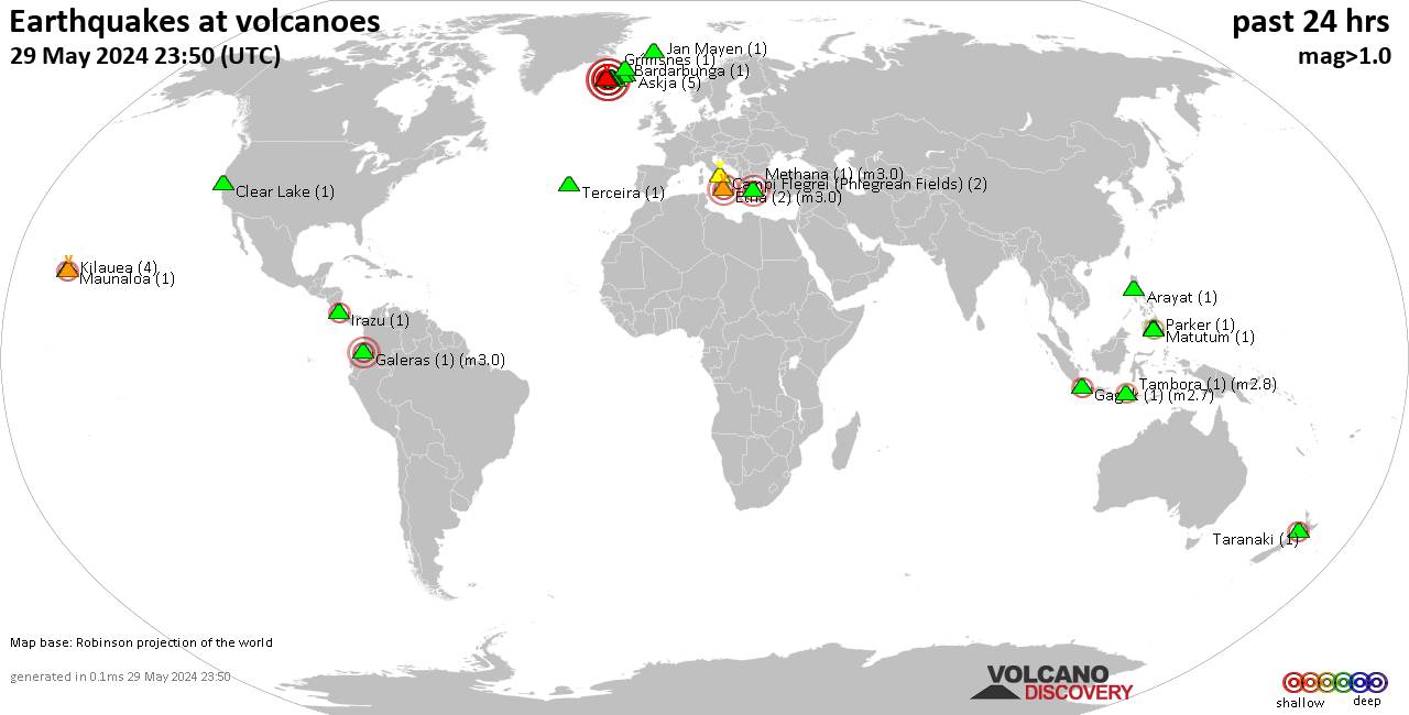
JMA reported that eruptive activity at Suwanosejima's Ontake Crater continued during 20-27 May. Crater incandescence was observed nightly in webcam images. An explosion at 0019 on 22 May generated an ash plume that rose 900 m above the crater rim and drifted W.
Wed, 29 May 2024, 14:00INSIVUMEH reported that eruptive activity continued at Santa Maria's Santiaguito lava-dome complex during 21-28 May with continuing lava extrusion and block collapses and avalanches at the Caliente dome. Sometimes the avalanches are audible several kilometers away. Incandescence from the dome was visible during most nights and early mornings, and occasional incandescence was also present along the upper parts of the lava flow on the WSW flank.
Wed, 29 May 2024, 14:00
Instituto Geofísico del Perú (IGP) reported that the eruption at Sabancaya continued at moderate levels during 20-26 May with a daily average of 40 explosions. Gas-and-ash plumes rose as high as 2.5 km above the summit and drifted less than 10 km E and NE. Thermal anomalies over the lava dome in the summit crater were identified in satellite data.
Read all
Wed, 29 May 2024, 14:00Observatorio Vulcanológico y Sismológico de Popayán, Servicio Geologico Colombiano (SGC) reported that seismic activity at Puracé decreased during 21-24 May and continued to be at pre-29 April levels. Both volcanic tremor (VT) associated with rock fracturing and long-period (LP) events associated with fluid movement were located less than 2.5 km beneath Puracé crater and had low magnitudes. Gas emissions from the crater and the N flank fumarole were occasionally visible in webcam views.
Read all
Wed, 29 May 2024, 14:00
BPPTKG reported that the eruption at Merapi (on Java) continued during 17-23 May. Seismicity had decreased compared to the previous week. The SW lava dome produced 138 lava avalanches that traveled as far as 1.9 km down the Bebeng drainage on the SW flank.
Read all
Wed, 29 May 2024, 14:00PVMBG reported that eruptive activity at Marapi (on Sumatra) was ongoing during 22-28 May. White gas-and-steam plumes rose 200-300 m above the summit and drifted SW, S, and SE on most days; no emissions were visible on 22 May. At 0350 on 26 May a dense gray ash plume rose around 1 km above the summit and drifted S.
Read all
Wed, 29 May 2024, 14:00
PVMBG reported that the eruption at Lewotolok continued during 22-28 May. White steam-and-gas plumes rose 200-700 m above the summit and drifted W and NW. On 25 May white-and-gray ash plumes rose as high as 500 m and drifted W and NW.
Read all
Wed, 29 May 2024, 14:00PVMBG reported that eruptive activity at Lewotobi's Laki-laki volcano continued during 22-28 May. Gray-and-white ash plumes rose 100-800 m above the summit and drifted N, SW, and W during 22-25 May. White steam-and-gas plumes rose as high as 100 m above the summit and drifted W and SW during 26-27 May.
Read all
Wed, 29 May 2024, 14:00
The Darwin VAAC reported that at 1040 on 28 May an ash plume from Kerinci was identified in a satellite image drifting SW at 5.8 km (19,000 ft) a.s.l., or 2 km above the summit. PVMBG noted that white steam-and-gas plumes rose 200 m above the summit that same day. The Alert Level remained at 2 (on a scale of 1-4) and the public was reminded to stay 3 km away from the crater.
Read all
Wed, 29 May 2024, 14:00In a special notice for Kanlaon, PHIVOLCS stated that the seismic network detected 24 volcano-tectonic earthquakes during 1335-1630 on 26 May with local magnitudes of .8-2.3 and depths of 0-6 km beneath the W flank. Sulfur dioxide gas emissions from the summit crater had been elevated since 1 January, averaging 1,291 tonnes/day (t/d); the most recent measurement was 2,003 t/d, recorded on 26 May. Ground deformation data from continuous GPS and electronic tilt data had been recording inflation at the volcano since March 2022.
Read all
Wed, 29 May 2024, 14:00
AVO reported that slow lava effusion in Great Sitkin's summit crater was last confirmed in a 22 May radar satellite image with continuing inflation over the vent and advancement of the NW lava lobe. Lava was filling in a crack just SW of the vent. Effusion likely continued during 23-28 May.
Read all
Wed, 29 May 2024, 14:00INSIVUMEH reported that eruptive activity continued at Fuego during 21-28 May. Explosions were recorded daily, averaging 1-10 per hour on most days, when counts were reported. The explosions generated gas-and-ash plumes that rose as high as 1.1 km above the crater rim and drifted as far as 30 km W, SW, and S.
Read all